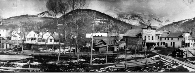
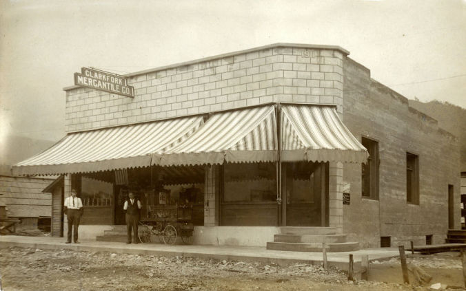
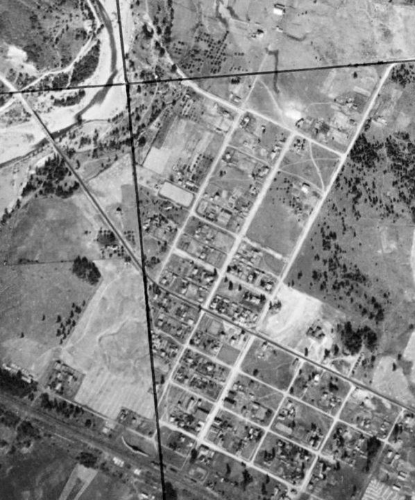
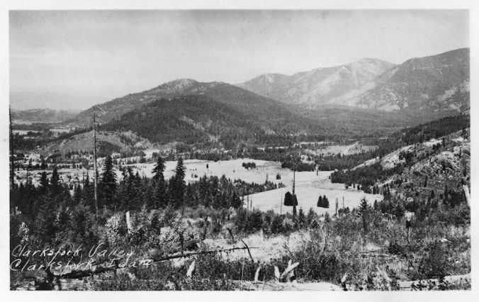
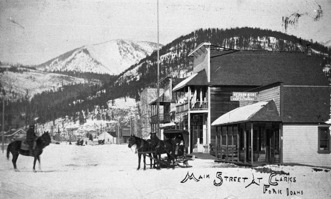
The City of Clark Fork became a viable town in the early 1880's as the construction by the Northern Pacific Railroad continued through the nearby Bitterroot and Cabinet Mountains. This small community has been geared towards mining, logging, sawmills, farming, Forest Service activity, fish hatcheries, dam construction and fur trapping. Also, for most of its history the railroad maintained a station and section crew in Clark Fork. Clark Fork was incorporated 1911.
In the 19th century the Clark Fork Valley, like the shores of Lake Pend Oreille around Hope, was inhabited by the Flathead tribe of Native Americans. It was explored by Meriwether Lewis of the Lewis and Clark Expedition during the 1806 return trip from the Pacific. The river is named for William Clark. A middle segment of the river in Montana was formerly known as the Missoula River.
Much of Clark Fork's story over the following years had to do with crossing the river. The bridge fording the Clark Fork River provided one of the only passes to the north, and with the steamboats bringing miners making the arduous journey to the Kootenai gold rush, this was one of the only ways to travel. Before a bridge was built, Clark Fork had a ferry to make the crossing. Early ferries were nothing more than logs lashed together. Later, some records indicate a ferry was operating in 1893, but this was a decade after the Northern Pacific line was put in place, so it is safe to assume there was a brisk business with ferry crossings during construction.
It is important to be reminded that the Cabinet Gorge Dam was not in place then, and reporters at the time wrote in 1916 that "The Clarks Fork river handles a volume of water much larger than the Snake river. At times during high water, the flow amounts to as much as 94,000 cubic feet per second. The average width of the river is about 1300 feet. The velocity of the river at certain times is very large, about eight miles an hour. Due to this it is necessarily very hazardous to operate a ferry at Clarks Fork at any time and very dangerous and at times impossible to operate a ferry at all."
Certainly, this ferry crossing created a need and a place for travelers, not only to cross, but at times to rest, restock supplies, and take advantage of the occasional saloon.
Until WWI there was a lot of sawmill activity, then to a lesser degree through the 1950s. Early sawmills include McGillis and Gibbs, Lane and Potter. From the start until the late 1950s, mining operations played an important role in the community's economy. The Whitedelph mine and mill located near the Spring Creek fish hatchery began operation in 1926 until it closed in 1958. It yielded galena ore assaying principally in silver, lead and zinc. The Lawrence mine was located on Antelope Mountain near Mosquito Creek. Area hills and mountains had numerous small mining holes tended by small operations and prospectors.
No one knows now for sure the identity of the first person to put down permanent roots in what would become Clark Fork. Native Americans had long travelled through this area but were not believed to have made any permanent settlement; trappers found bountiful wildlife and the odd prospector or two undoubtedly roamed the mountains looking for a lucky strike. But whites, along with hundreds of Chinese laborers, didn’t really come to the area in force until the early 1880s, when the Northern Pacific Railroad carved its Clark Fork Division out of this portion of the Cabinets.
In the 1880 census for Kootenai County, which at that time included the Clark Fork area, no names were listed as resident in this vicinity. Ida Daugharty Hawkins, however, whose grandparents arrived in the area in the 1880s and is an avid amateur historian, names John Nagel as the area’s first settler. He and his wife, Annie, received a federal patent in 1900, and John was the man who platted most of the land he homesteaded into the residential and business district of today.
If Nagel wasn’t the very first resident (and he likely was), he was certainly one of the most influential. He was the first postmaster, donated the land where the Methodist Church stands, partnered in the general store and fathered the first child—his daughter, Alice—to be born in Clark Fork.
A 1950 article in the News-Bulletin names Herman (Fitz) Vogel, Sr. of Clark Fork as the longest resident of Bonner County (Nagel had died 15 years earlier.) The Vogels were another family among the original settlers.
Vogels and Nagels were on the 1900 census for the Clarks Fork District. Herman Vogel (from Switzerland) was there with his wife Catherine and working as a “tie-maker” (likely related to the railroad, not fashion). John Nagle (from Germany) and his wife Annie are found around 50 entries later; John is the manager of a sawmill at this time, though he had also worked as a tie-maker in previous years.
Look through that 1900 census, in fact, and you’ll find more names that ring with familiarity; at least, they will if you’ve spent any time around this little community on the east end of Bonner County.
John White of Mississippi, whose son and grandson would both go on to represent Idaho in the U.S. Congress, was the railroad station agent; William Derr of New York and John Derr of Michigan were both farmers; James Brashear of New York was a bridge builder.
~Taken from:Bonner County Historical Museum
Glacial Floods and Lake Pend Oreille History
The Hope/Clark Fork area stretches along the shores of Lake Pend Oreille from the Pack River to the mouth of the Clark Fork River, the major waterways that feed mighty Pend Oreille. Lake Pend Oreille is one of the West's largest freshwater bodies of water with several islands near the Clark Fork estuary, including the islands off Hope and the Hope Peninsula, Warren, Cottage, Pearl, Eagle, and Memaloose Islands, as well as the Islands at the end of the Clark Fork River, called the Clark Fork Flats, which includes Derr Island. There are three major peninsulas that thrust into the lake: Sunnyside, the Hope Peninsula, and Sagle. Sagle is actually more like an area the lake wraps around, but nonetheless is a major abutting feature of Lake Pend Oreille.
It is important to note that the histories of the two communities are closely tied to one and other. They have a shared past of railroads, mining, and logging, and sportsman activities. Lake Pend Oreille and the Clark Fork River have been a draw for tourists seeking the mountain/lake lifestyle. However, with the federal and state owning over 70% of the land, growth has been measured.
The most prominent feature of Hope and Clark Fork, Idaho is Lake Pend Oreille. With 111 mile of coastline and 148 square miles, it is one of North America's prominent lakes, and the nation's fifth deepest. Formed by cataclysmic floods when the mile-high Ice Age ice dam broke time after time, the features of the land and lakes of Bonner County and Western Montana all the way to the coast in Oregon were formed by these monumental floods. Just one of these deluges was ten times the combined volume of all the rivers on earth, with walls of water moving at super highway speeds. To learn more about the Ice Age Floods visit http://www.iceagefloodsinstitute.org/
Centuries before white man discovered the region, the Kalispell and other Indian tribes, such as the Flatheads, inhabited North Idaho. The first white men to trade in North Idaho were the intrepid adventurers "Big Finan" McDonald and explorer and "land geographer" David Thompson, who established the first permanent wooden structure in 1809 on the Hope Peninsula, taking advantage of Lake Pend Oreille and the Clark Fork River. This trading post, Kullyspell House, is still standing as a stone building on the shores of the lake.
The first true transportation the region enjoyed were the steamboats of the Oregon Steam Navigation Company, which brought its first engine and hardware from Portland, building the 108-foot Mary Moody in 1866.
As the railroads came into the area, Northern Pacific Railroad built the 150-foot Henry Villard in 1883 to supply the men laying the rails. Steamboats continued to be an integral part of transportation around Lake Pend Oreille until the 1930s.
In 1864 Congress granted the Northern Pacific Railroad a charter to build a line from Lake Superior to Puget Sound on a route north of the 45 parallel. In 1872, the Clark Fork Pend Oreille route was chosen. With the railroad came the people who established the towns of Clark Fork and Hope.
Railroads came to prominence in the 1880s, as local construction began on the northern transcontinental line in 1881. Trestle Creek, at more than a mile long, became the line's longest structure. It was at this time that Hope became the center of railroad activities and the largest city in the county. Along with Chinese Coolies, over 4,000 rough and ready railroad workers lived in a tent city along the Clark Fork River. Railroads brought people, and the lumber industry, which began to service the rails and trains, became the stalwart of the North Idaho economy for the next 100 years.
Steamboats crossed the lake carrying supplies and mail to mining sites around the shore before roads were built. The boats were used to carry supplies up the Clark Fork River to Cabinet Gorge while the railroad was being constructed. The lake had long supported a fishing fleet, bringing in tons of fish every day. The populations were decimated by the introduction of tiny krill. The Federal government added these small shrimps in an attempt to increase fish populations; the experiment had the opposite effect. Recent years have seen a small recovery in fish populations, and now Hope is the center of some fine sports fishing.
Hope had a large Chinese population which had arrived with the railroad, and Jeannot supposedly took advantage of this source of cheap labor for his mines. According to one of Jeannot's friends, he allowed these men to use the meat cooler under the hotel as a clubhouse. They gained access to this room through the small tunnel which connected it to the railroad depot, thus bypassing the more obvious entrances. This vault in the hotel is one of the few sites left in Hope which may be connected with the large number of Chinese who used to live in the town.
~Taken from:Bonner County Historical Museum
